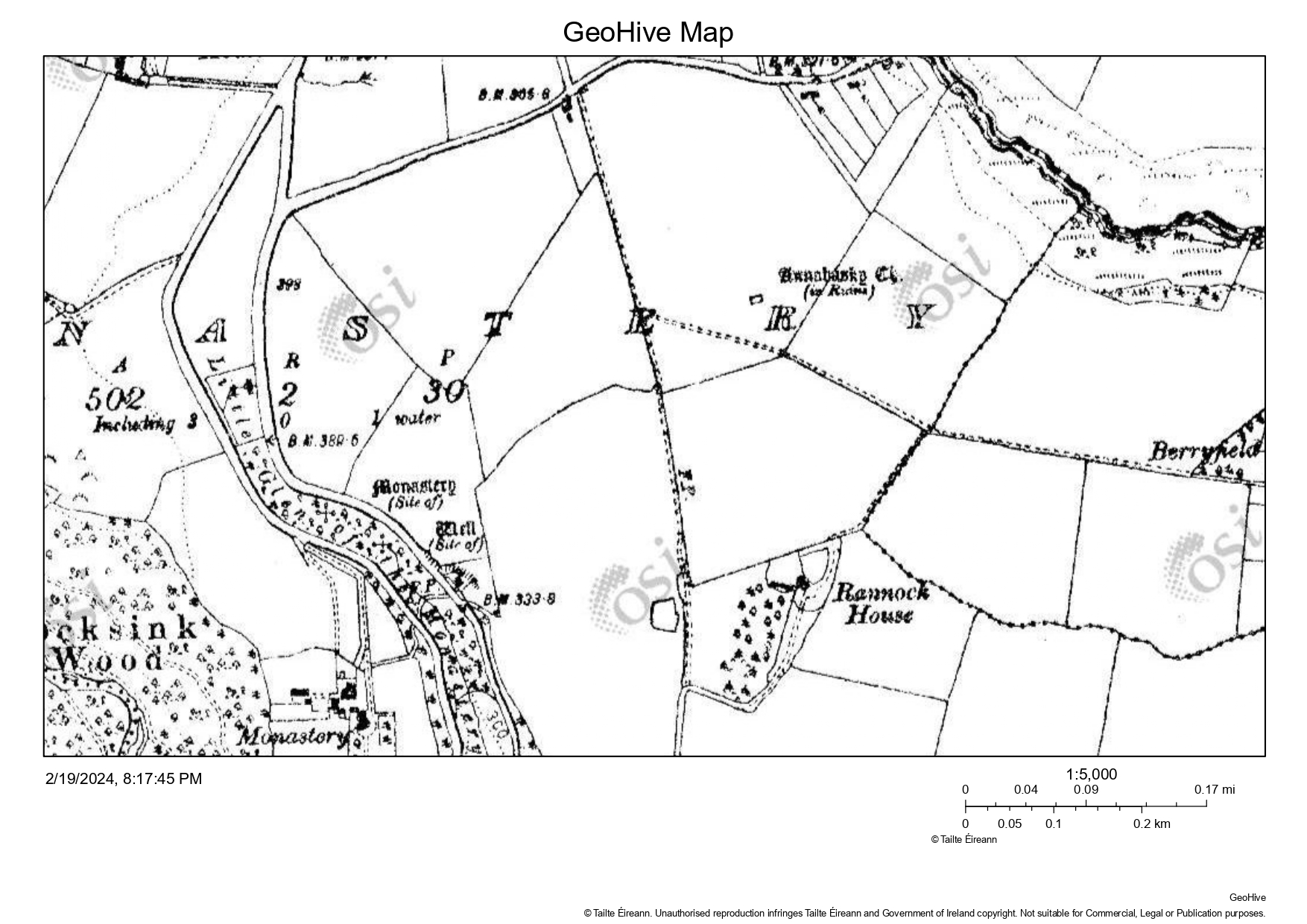
Annahasky Church, near Enniskerry

Annahaskin or Annahaskin Church is located in the townland of Monastary, north of Enniskerry. The church is in a field just north of Rannock House and close to the county boarder with Dublin. The church was located on lands owned by St Thomas’s Abbey and to the west in the same townland, the early O S maps records a site of a Monastery and well. The church would appear to get its name from the South County Dublin townland of Aghnahaskin, which translates to “Ford of Eels”.
In Liam Prices 1931 entry in his notebooks, he records that only a broken piece of wall remained. He recorded that, the traces of wall in 1931 external measurements were about 7 x 17 paces. Though in the O S survey in 1837, O’Curry recorded the foundation traceable and measuring 24’ by 18’.
Across the old roadway from the church is another “heap of stones” and in the 1930’s the locals in the area were recorded as saying these stones were supposed to be the clergyman’s house or priest’s house.
Bibliography
Price, Liam The Price Notebooks, Volume 1 and Volume 2, (editors Christiaan Corlett and Mairead Weaver), An Roinn Comhshaoil agus Rialtais ítiúil / Department of the Environment and Local Government, 2002
Turner, Kathleen If you seek Monuments, a guide to the antiquities of the Barony of Rathdown, Rathmichael Historical Society, Rathmichael
Scott, Canon George Digby The Stones of Bray, Cualann Publications, Bray, 1984


No Comments
Add a comment about this page